|
The BLM, with assistance from Central Oregon Trail Alliance (COTA), is working to assess the user experience at Horse Ridge and consider adding the trails to its inventory. We intend to receive feedback from all user groups, including but not limited to, hikers, horseback riders, mountain bikers, and runners. Please take a moment of your time to fill out this survey, and help with this important process.
0 Comments
COTA is a 100% donation based non-profit that plans, builds, and maintains 500 miles of singlettrack in Central Oregon. As trail work season kicks off, we want to hear from riders like you! Please take a second to fill out our first annual rider survey.
We'd appreciate feedback from the entire mountain biking community so we can get a full sense of what is expected of our work. Thank you to all volunteers, members, and trail lovers who make this possible. For those who don't know, non-system trails are social trails made by individual people that were not approved by the Forest Service. These trails have a significant impact on archeological, geological, and natural resources. It is extremely important to only use designated trails to ensure our wildlife impact is at a minimum. We can only continue to build more trails when our impact is at a minimum!
COTA's staff, board, and volunteers work tirelessly to maintain and build new trails to enhance the mountain biker experience of Central Oregon. It takes several years to go from a new trail idea, to implementing a building plan, to a new trail ready for use. When non-system trails are created, our resources have to be diverted to closing the social trail, as opposed to working on building more! Our Executive Director Emmy spoke on the issue with KTVZ News last night, Feb 15th 2022. Find the whole video on non-system trails here. Our vision is to create a robust and diverse mountain biking experience that will endure for generations. We need your help to make sure that happens by staying off non-system trails, and reporting them to COTA, or USFS. This way, our resources stay focused on creating new trail systems! Bend and Springfield, Ore. — Today, the Deschutes and Willamette National Forests announce changes to the Central Cascades Wilderness Permit System. The changes are designed to improve the permit system following last summer’s first year of implementation. The changes will increase permit opportunities for the public and simplify the permit system. NEW CHANGES:
Find a full detailed outline here, or view the official USFS press release below. COTA's South Deschutes County Chapter Wins Building a Better Central Oregon Award from COAR11/4/2021 Every year Central Oregon Association of Realtors asks our local community members to nominate those who are Building a Better Central Oregon in various categories such as Best Overall Service to the Central Oregon Community, Outstanding Contribution to Youth Achievement, and Best New Recreation Option. BBCO's main purpose is to recognize worthy residents who have enhanced their community with outstanding new or renovated residential, commercial or industrial buildings. Projects are judged on economic impact, neighborhood improvement, unique design or use of materials. Our SoDeCo Chapter (South Deschutes County) earned the Best New Recreation Option by working diligently with the US Forest Service to gain approval for new trails, and then by joining forces with local individuals and businesses in the Sunriver area to design and build over 10 miles of singletrack mountain bike trails. These new trails, complete with informational kiosks, connect the Sunriver area to the Wanoga network of trails near the Cascade Lakes Highway. Dan Youmans, our SoDeCo Chapter Representative, has been instrumental in making mountain bike trails in the Sunriver and LaPine a reality. He's also excited about adding more trails to the Newberry Crater trail network, and the possibility of extending mountain bike trails from Sunriver to La Pine State Park to the City of La Pine. If you'd like to reach Dan, please email him here. Building a Better Central Oregon: Best New Recreation Option COTA South Deschutes County Trails Central Oregon Trail Alliance Sunriver, OR To learn more about other BBCO award winners, click here. Central Oregon Trail Alliance (COTA) has been awarded a generous grant from the Bend Sustainability Fund to assist us with building the Stinger Trail in the Cascade View trail system near Cline Buttes and Eagle Crest Resort. Our Statement of Success: A new trail with beautiful mountain views in a less crowded part of Central Oregon that primarily appeals to mountain bikers but is also open to people on foot and draws locals and visitors to get fit, happy, connect with nature, and experience the beauty of Central Oregon. We're thrilled to be a BSF grant recipient. The BSF will help COTA complete a challenging trail and will provide much-needed community financial support to many deserving recreation projects now and for years to come. And a huge thank you to the more than 400 people that voted for COTA's project in the Community Ballot - you helped make this project happen! The Bend Sustainability Fund invests in projects that protect, steward, and create sustainable recreational resources and outdoor experiences in Bend’s backyard. Their motto, Taking care of the places that take care of us by investing in what makes Bend such a special place, exemplifies their mission perfectly. COTA's Cascade View Trail Construction project was one of eight projects reviewed by Visit Bend staff and the BSF Advisory Council, presented to the community through the Community Ballot, where they received nearly 1,800 responses in support of these projects, and approved by the Visit Bend Board of Directors. 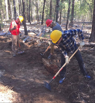 Our annual Fall Trail Love event will be held on Saturday, October 16th, with some additional work events on Saturday, October 23rd. Due to Covid, we are going to be doing it a little differently this year and will have small groups, led by Chapter Reps and Crew Leaders, hit the trails to get work done in a safe and socially-distanced manner. So many options to lend a hand! Check out the many events by going to our Meetup page here. For everyone who comes out to help on Trail Love this fall, you'll get a free laser-engraved custom COTA engraved stem cap! Project321 kindly donated a whole bunch of these and our Board President, Alex Anderson, ran their laser machine. Project321, thanks for making our volunteers look so good!  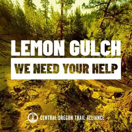 COTA needs our members' help! Plans for Lemon Gulch, a proposed 50 mile trail network in the Ochocos 4+ years in the making, are threatened by a small group of private parties.
The oposition is primarily three ranches that hold grazing permits for a short period of time each summer in Lemon Gulch. They do not feel that it is possible coexist with mountain bikers. We believe we can navigate their concerns and we feel strongly this is the best location for this trail network but need to push for that conversation to happen. Please contact the representatives listed below to show your support for the proposed Lemon Gulch trails. Feel free to use your own words on why you support these trails or use the language here: -------------------------------------------------- Dear ______, I’m contacting you because I support the proposal to add a network of mountain bike trails to Lemon Gulch just outside of Prineville in the Ochoco National Forest. These public lands offer a great riding opportunity for mountain bikers of all ages and abilities in an area where there will not be conflicts with other trail users. The project will have positive health and economic benefits for the community. Of the many areas initially proposed, Lemon Gulch has been identified by the Forest Service as the most appropriate area for this trail network. The Lemon Gulch proposal is the result of a multi-year process, initiated by the Forest Service and the Prineville Chamber of Commerce, that has included many stakeholder groups and members of the community and it is important that the outcome of this process be respected and not derailed by a small group of private parties attempting to restrict access to public land. -------------------------------------------------- Crook County Commissioners: Commissioner Jerry Brummer Phone: (541) 447-6555 Email: [email protected] Commissioner Brian Barney Phone: (541) 447-6555 Email: [email protected] Oregon State Representatives: State Senator Dennis Linthicum Phone: (503) 986-1728 Email: [email protected] State Representative Vikki Breese-Iverson Phone: (503) 986-1455 Email: [email protected] US Congress: Congressman Cliff Bentz Phone: (202) 225-6730 Email: https://bentz.house.gov/contact US Senators: Senator Jeff Merkley Phone: (202) 224-3753 Email: https://www.merkley.senate.gov/contact Senator Ron Wyden Phone: (202) 224-5244 Email: www.wyden.senate.gov/contact/email-ron -------------------------------------------------- You can find more information about the Lemon Gulch project at Ochoco Trails: ochocotrails.org/current.../ochoco-national-forest/ August 6, 2021 - Bend Bulletin column written by Emmy Andrews.
Trail work follows the seasons. In winter, trails are blanketed under snow and little or no trail work occurs. As spring arrives and the trails emerge from the melting snow, a small army of mostly volunteer trail workers gets busy. They use chainsaws and hand saws to remove trees that have fallen across the trail. They use loppers and power brushers to cut back shrubs that are growing into the trail. They use shovels and other hand tools to complete small projects to improve trail drainage, prevent erosion, correct trail widening and more. They use machinery such as skid steers for larger maintenance projects such as reshaping jumps on mountain bike trails and building new trails. They work furiously as summer approaches, and their work becomes sweatier and dustier with each passing week. As temperatures rise and the soil dries out — which seems to happen faster and sooner each year — certain types of trail work projects become unfeasible. Imagine building a sandcastle on the beach. As the sand dries, it won’t stick together and becomes impossible to shape. Similarly, as Central Oregon soil dries out, it becomes nearly impossible to do trail work such as reshaping dirt jumps. As soil dries, another more familiar shift also occurs: The risk of wildfire increases. Trail work and wildfire risk are linked by a relatively unknown designation: the Industrial Fire Precaution Level . IFPLs start at Level I and go up to Level IV. At Levels II and III, the use of powered equipment and certain activities are limited. At Level IV, all use of power equipment and all industrial activities are suspended. IFPLs apply to lands managed by the U.S. Forest Service and Bureau of Land Management . As described on the Deschutes National Forest website, IFPLs “pertain to permitted activities such as timber sales, service contracts and firewood cutting.” As the name implies, the IFPL system restricts certain activities associated with logging and other industrial activities as fire danger increases. IFPLs stipulate things an operator can’t do, such as not use machinery at certain times of day in dry conditions. IFPLs also prescribe things an operator must do, such as use spark arresters, carry a fire extinguisher and perform a fire watch after operations conclude. This year, local Forest Service and BLM lands went from Level I to II in early July and raced onward through the levels, entering IFPL IV a mere two weeks later, on July 17. The IFPL is likely to remain at Level IV, the most restrictive level, until well into fall, when moisture returns. Trail work activities are subject to IFPL requirements and restrictions. At IFPL IV, if a tree falls across the trail, trail workers can’t use a chainsaw to cut it. They must leave it there or cut it with a hand saw. If a new trail is being built, they must use hand tools and can no longer use machinery to speed the process along. Trail workers happily comply — no one wants a wildfire — and await the onset of fall, when moisture will return and any affected trail work projects can continue. IFPLs also affect trail and road closures. At IFPL IV, because forest thinning operations are suspended, trails and forest roads in the thinning area that were previously closed Monday to Friday are now open. As citizens and users of public lands, it is important to understand how to recreate responsibly as fire danger increases. While IFPLs affect industrial operations, high fire danger also necessitates recreational restrictions such as not having campfires and not driving or parking on dry vegetation. Thanks for recreating responsibly! Article published here. |
Bike Park 242 Revamp on Singletracks Podcast 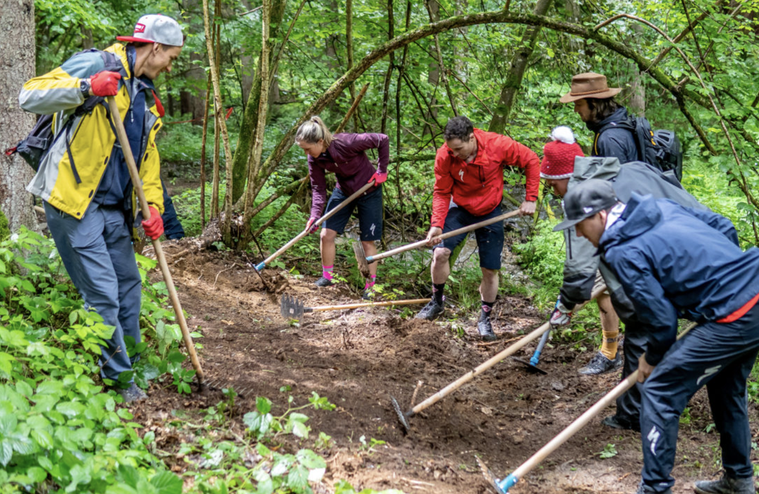
Alex Brieger in Singletracks podcast, "What's a MTB Trail Builder's Pet Peeve? Here are Two Big Ones" 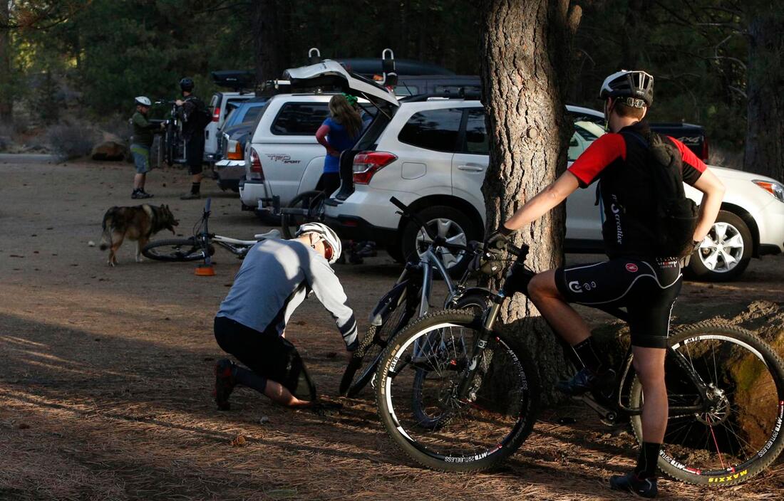
Phil's Skills Area and Pump Track Facelift 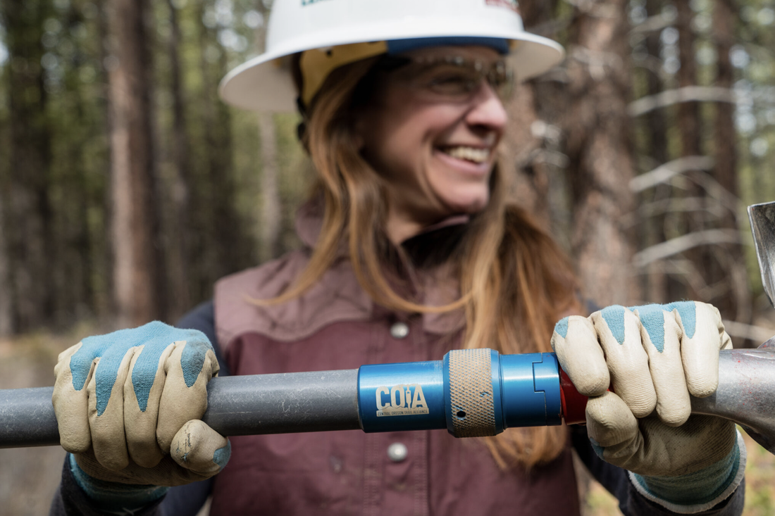
Singletracks podcast featuring Emmy Andrews 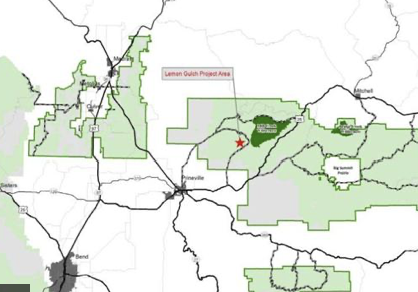
New article on Lemon Gulch featuring Emmy Andrews and Travis Holman 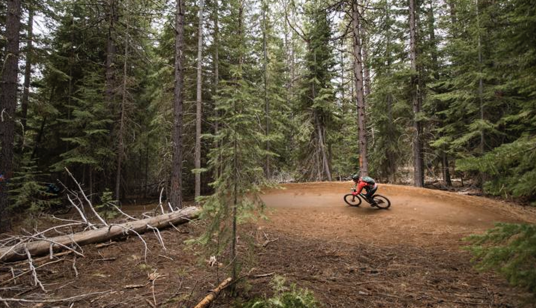
New Article about Royal Flush with comments from Dan Youmans 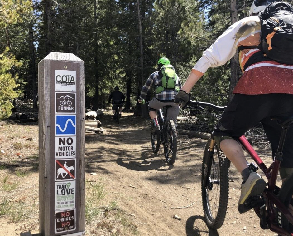
Emma Maaranen's article about Funner |

|
Support UsGet Involved |


Copyright © Central Oregon Trail Alliance. All rights reserved.